Isle of Skye Map | For A Stress-Free Island Adventure

For first-time visitors to Skye, a clear and accurate map of the Isle of Skye is not just helpful - it’s essential.
Living in the Western Highlands means we’ve travelled across Skye extensively, and one thing is always clear: Skye is not an island you can criss-cross quickly. And thinking you can simply hop between attractions, seeing all the highlights in a day, is where many Skye itineraries start to unravel.
Instead, the island is best understood as a series of distinct peninsulas, each stretching into the sea where black volcanic cliffs meet wild waters. The result is a landscape of unparalleled drama.
On a practical note, this complex topography also means that the island’s attractions, walks, places to eat, and accommodation are spread across these long fingers of land - and moving between them almost always means returning to a central road before heading back out again.
This guide (and the Isle of Skye itinerary it’s built around) will help you plan days that actually make geographic sense. It’s also designed to help you avoid the most common mistakes first-time visitors make, namely underestimating driving times!
Save countless hours planning your dream Scotland trip. Book your Planning Session today.
Isle of Skye Map
This map of the Isle of Skye highlights the island’s main peninsulas, towns and villages, and key hubs. Understanding this layout is the key to building a calm, realistic Skye itinerary - and enjoying the island without feeling rushed.
Remember, Skye is about 50 miles (80km) long and 25 miles (40km) wide at its broadest point, covering an area of approximately 1,656 sqkm (639 sq mi). This is Scotland’s second-largest island, and it’s bigger than you might think.
We can’t stress enough, don’t underestimate how long it takes to get between destinations!
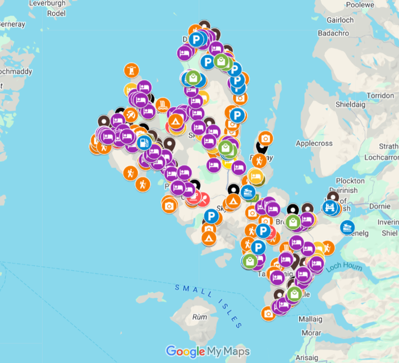
You’ll find this carefully pinned Skye map inside our island itinerary and travel guide.
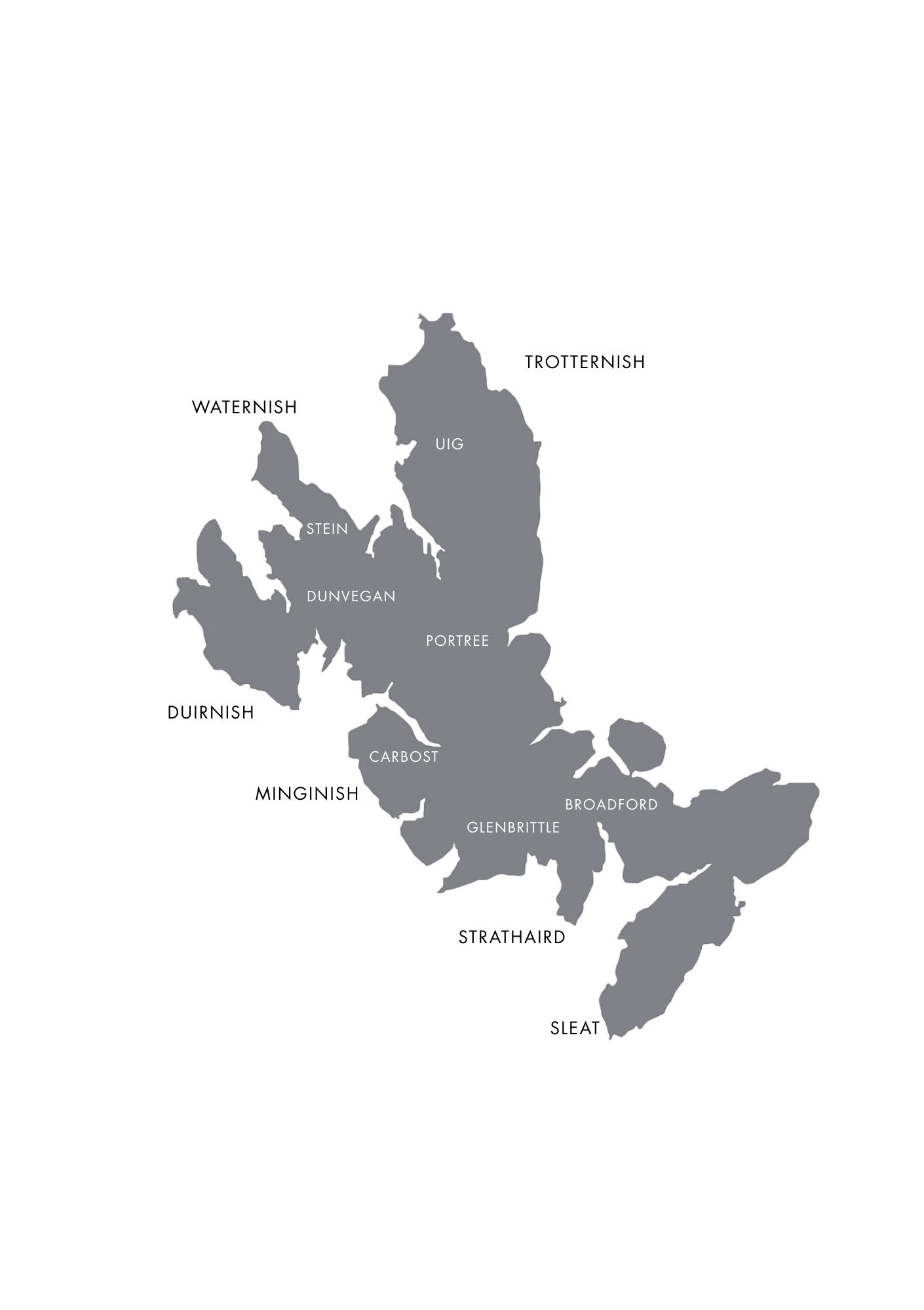
Skye’s Main Regions and Peninsulas
Broadly speaking, the Isle of Skye is best understood as a collection of distinct peninsulas. Each has its own character and highlights - and each works best when explored as a cluster, rather than dipped into briefly from across the island.
Find them: on this Skye map & itinerary
Towns, Villages & Hubs
-
![]()
Portree
Discover Skye’s capital, colourful harbour houses, restaurants, busy bars and stylish hotels alongside coastal walks.
-
![]()
Elgol
Coastal communities, cafes, Loch Coruisk boat trips, Bla Bheinn, Spar Cave, Torrin Pools, and the dramatic shores of Loch Scavaig.
-
![]()
Carbost
For Talisker Distillery and foodie hotspots Cafe Cuil, Oyster Shed, Old Inn, and Talisker at Three Chimneys, beside pretty Carbost.
-
![]()
Trotternish
Home to many of Skye’s most famous sights, including the Old Man of Storr, the Quiraing, Kilt Rock, Brothers Point, and Fairy Glen.
-
![]()
Stein
A world away from crowded hotspots, discover the coastal hamlet of Stein, and nearby artisans, galleries, and foodie finds.
-
![Whisky glass in a Scottish distillery that says Oban on the front]()
Broadford
The second largest town on the island, stay for amenities, excellent eateries, coastal walks, and easy access to the island’s south.
-
![]()
Sleat
Find the ferry port, Armadale Castle, Torabhaig Distillery, boutique shops, cafes, coastal hamlets, and refined hotels.
-
![]()
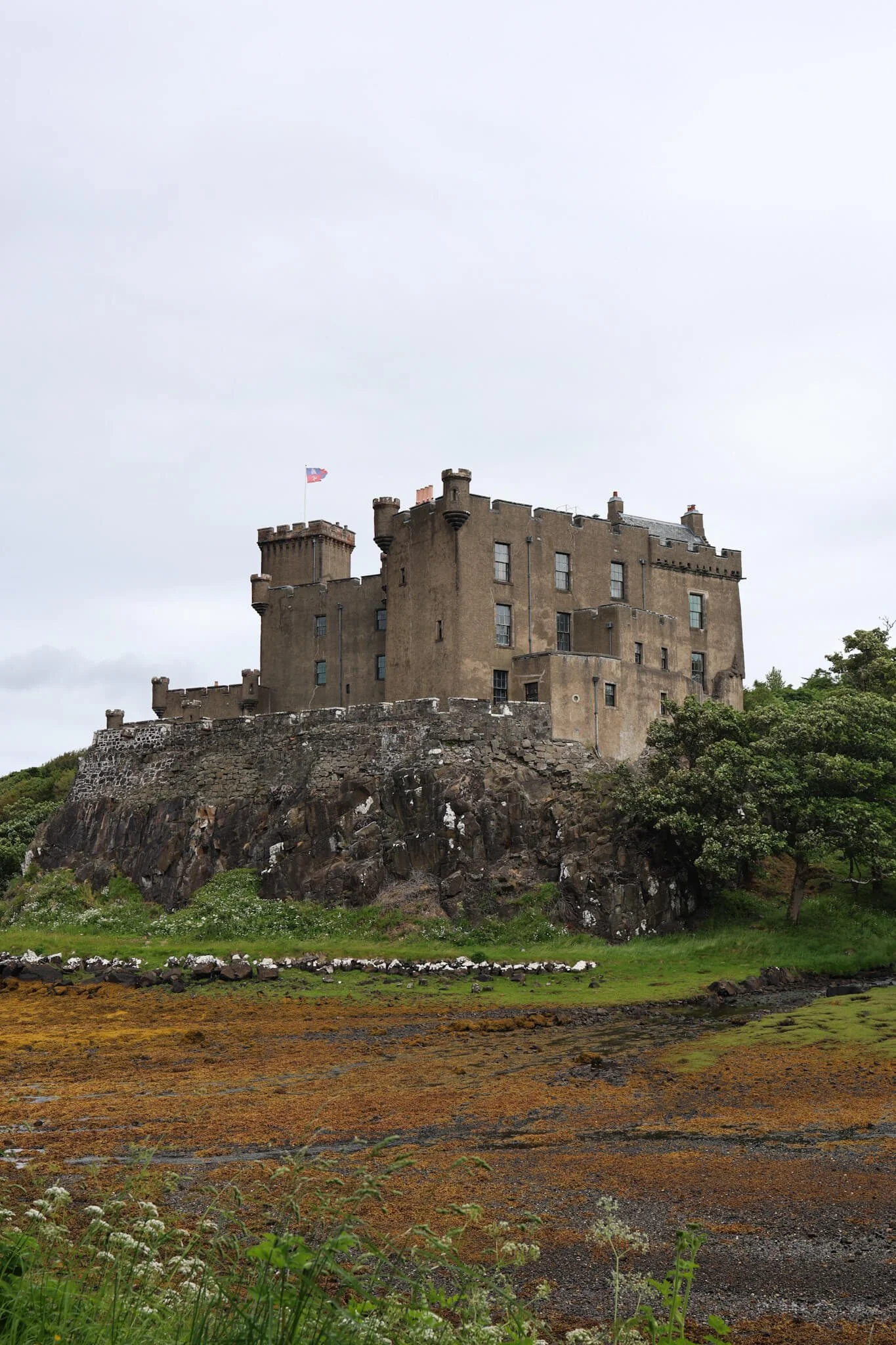
Dunvegan
Home to Dunvegan Castle, Coral Beach, boat trips on Loch Dunvegan, the Dunvegan Deli, and Three Chimneys.
-
![]()
Staffin
An idyllic village on Trotternish, nearby you’ll find cafes, clifftop walks, and dinosaur footprints at An Corran Beach.
-
![]()
Isle of Raasay
Peaceful walks, hikes, coastal villages and an excellent whisky distillery - a short ferry hop from Skye.
-
![]()
Sligachan
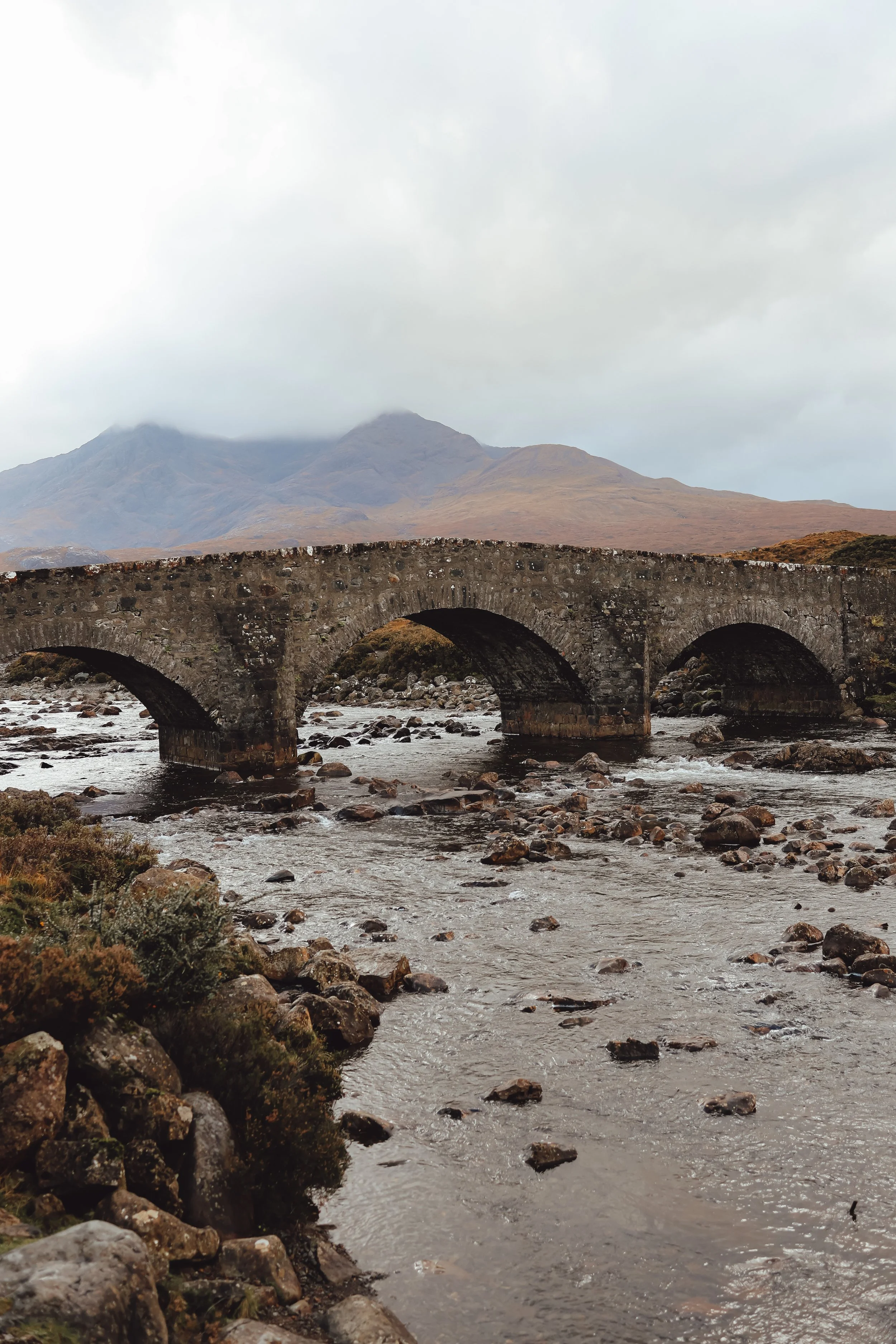
Explore The Old Bridge, Sligachan Waterfalls, and Glen Sligachan - key starting points for hikes into the Cuillin.


Skye’s Peninsulas
Trotternish Peninsula (North & Northeast): Home to many of Skye’s most famous sights, including the Old Man of Storr, the Quiraing, Kilt Rock and Mealt Falls, Brothers Point, and the Fairy Glen. Portree sits here, making this the island’s busiest and most visited region.
Waternish & Duirinish (West & Northwest): Reached by a long drive west from Portree, these quieter peninsulas are known for Dunvegan Castle, Neist Point Lighthouse, Stein, and some of Skye’s best destination dining. Roads are slower, but the pace is part of the appeal.
Minginish (Southwest of Portree): This peninsula is the gateway to Skye’s dramatic mountain scenery, including Carbost, Talisker Distillery, the Fairy Pools, Glenbrittle, and Sligachan — key starting points for hikes into the Cuillin.
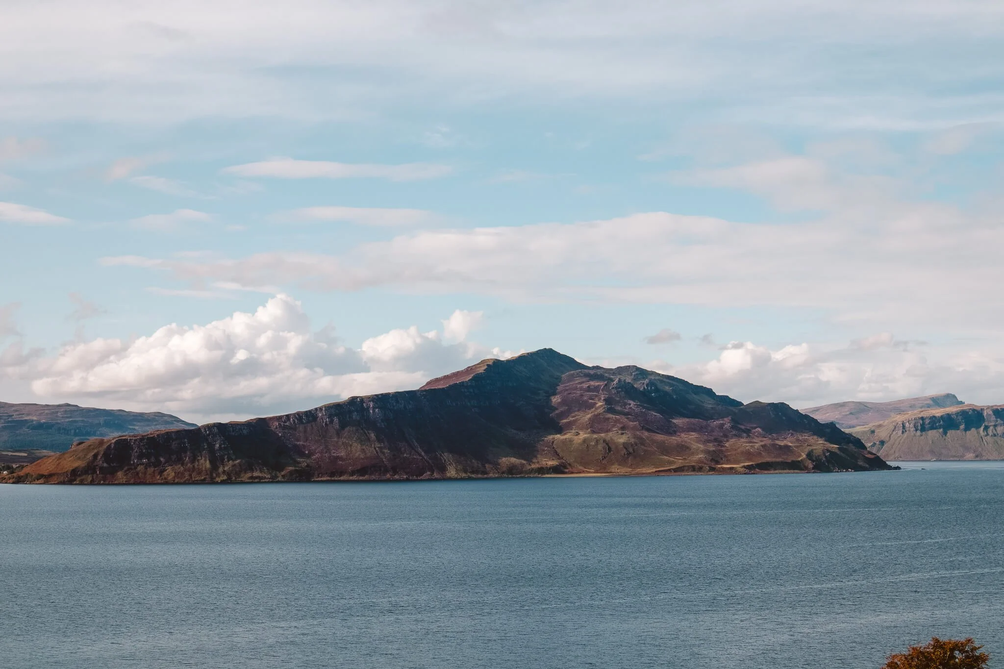
Strathaird (South-Central Skye): A lesser-visited and more rugged peninsula accessed from Broadford. Highlights include Elgol, boat trips to Loch Coruisk, Bla Bheinn, Spar Cave, the Torrin Pools, and the wild shores of Loch Scavaig.
Sleat (South Skye): Often referred to as the Garden of Skye, Sleat is greener and more settled. It’s home to the Armadale ferry port, Armadale Castle, Torabhaig Distillery, boutique shops, excellent eateries, and some of the island’s most refined accommodation.
Common Skye Geography Mistakes (and How to Avoid Them)
Most of the stress in a Skye itinerary comes down to a handful of geographical misunderstandings:
Trying to “nip across” the island: Skye simply doesn’t work like that. Sea lochs and peninsulas mean cross-island shortcuts simply don’t exist. And though places like Portree and Broadford are useful bases, reaching another peninsula almost always means driving back through them first.
Not pre-planning your days: In short, if you’re trying to maximise your days, you need to plan in advance and decide what you can realistically see in the time available.
Overpacking a single day with multiple stops spread across the island: Visiting the Quiraing, Fairy Pools, and Neist Point in one day looks feasible on a map - in reality, it’s (at best) exhausting. Plan your days around one region at a time, or those closest together, rather than driving back and forth across the island.
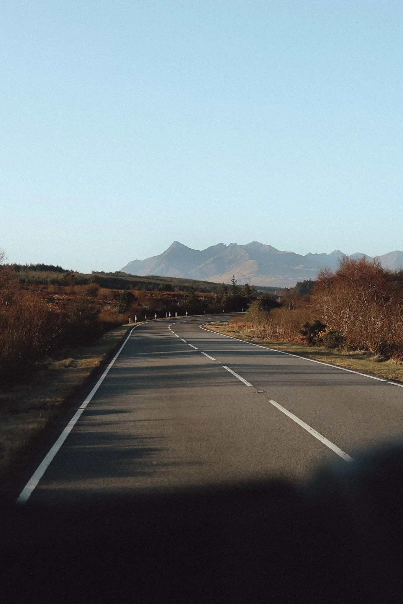
Underestimating single-track roads: Many of Skye’s most scenic areas are reached via narrow roads where progress is slow and passing places dictate the pace.
Choosing accommodation in the wrong area: Where you stay on Skye has a bigger impact on your daily plans than almost anywhere else in Scotland. Staying in the wrong place can add hours of driving over a week, even if the distances look small. If you’re looking for easy access to amenities, make sure your stay is within easy driving distance and not one of the island’s many remote options (and vice versa).
Assuming Google Maps understands the terrain: Mapping apps rarely account for weather, traffic pinch points, livestock, or visitor congestion at popular stops. And they're largely designed for urban environments, not rural roads. It’s not the first time I’ve found myself beating a hasty retreat along a muddy farm track because Google Maps thought it was a good option!
Understanding Skye’s geography (and planning your itinerary around it) removes most of these issues before you ever arrive.
A Journey Through The Isle of Skye
Planning Skye can feel surprisingly complex - there’s so much to see and do. Our Isle of Skye digital map and travel guide is designed to show you how the island actually works, helping you plan calmer days and smarter routes, alongside a 3 to 5-day itinerary you can follow.